Ground Radar (GPR)
During ground radar measurements our high-frequency radar antennas generate focused electromagnetic waves towards the ground, and the arrival time as well as intensity of the waves reflecting back from the layer boundaries are recorded. Performing the measurements along surveys or a lateral grid the depth and subsurface position of the layer boundaries and reflecting objects can be determined. During the measurements the antenna is slid on the ground, the recording is continuous and instantaneous allowing for a highly efficient surveying.
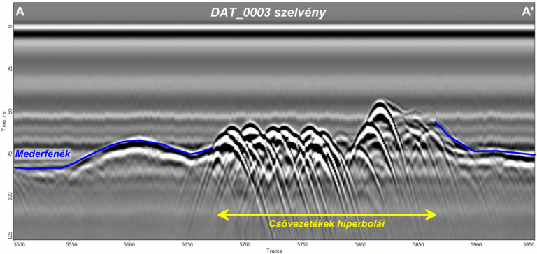
The depth of exploration using this method strongly depends on the frequency and power output of the antenna selected prior to the surveying as well as on the attenuation effect of the subsurface. The location of the surveying is positioned by GPS in all cases, which helps to place the results into a reference coordinate system. The radar profiles and maps obtained from the processing of the data are suitable for detecting and mapping subsurface objects having contrasting permittivities compared to their surroundings. Among many others we use this method for engineering geophysical studies, for detecting underground utilities and buried objects, structural investigations of road and dikes, geological surveyings and water table detection.
Our special, small, easy-to-carry high frequency antennas allow non-destructive surveying of walls and reinforced-concrete structures for example for utility or reinforced bar detection purposes. Being unique in Hungary, our antenna systems are fully waterproof and allow for carrying out measurements with the antenna being under water, close to the riverbed even up to a water depth of 5m. Using the submersible acquisition setup the maximum penetration below the lake or riverbed can be significantly increased.

