Geological and stratigraphic surveys

Our company considers the engagement in environmental protection a top priority. We have large experience and apply our non-destructive surveying techniques to recognize and protect our natural resources (for example surveying the environment of a hot spring or recultivated slope), to mark up the location of a water wells, or during other type of shallow geological exploration activities.

Depending on the problem to be solved, we use land seismic, geoelectric, ground radar and magnetic methods, whose depth of penetration and resolution varies on a wide spectrum.

What type of information can be gained from the geophysical measurements?

  • Depth and seismic velocity characteristics of the bedrock
  • Delineating inhomogeneous zones
  • Calculating soil mechanical parameters, providing Vs30 values
  • Determining stratigraphic column, delineating disturbed zones
  • Mapping of fractured zones and faults
  • Modeling groundwater flow
  • Estimation of electric resistivity conditions and grain size
  • Delineating clay plugs and lenses
  • Delineating contaminated zones in soil

Using our proprietary well database (DiPex), literature data as well as geological and structural data from nearby outcrops, validated geological models are constructed for the investigated area. The interpreted geological-geophysical sections are constructed using a joint, integrated interpretation process involving all geological knowledge as well as the results of the geophysical measurements.

Complex geophysical survey for slope condition determination

Geomega has performed geophysical investigations on the slope of a former open-cut coal mine.

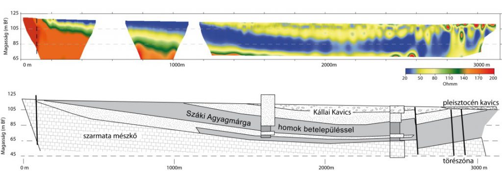
It was known from borehole data that the coal is found interbedded into a clayey section. On the earlier photos, the densely vegetated slope is seen characterized by steep walls. Later, during the shaping of the current slope, the rough surface was leveled and smoothed and the produced material was filled into the topographical lows. Nowadays, huge openings and ruptures are visible on the surface being the result of slope slumping.

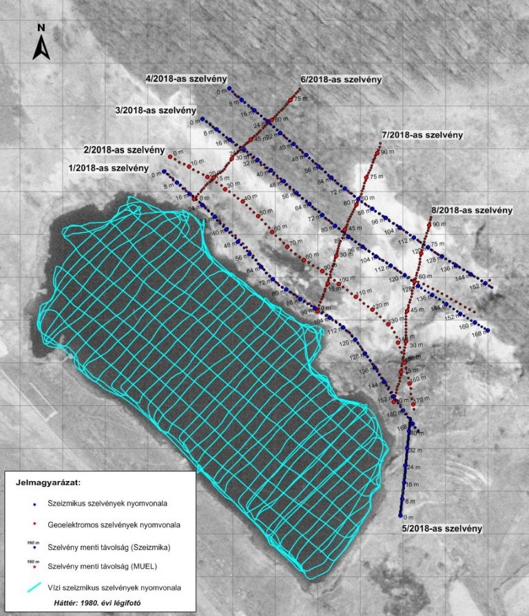
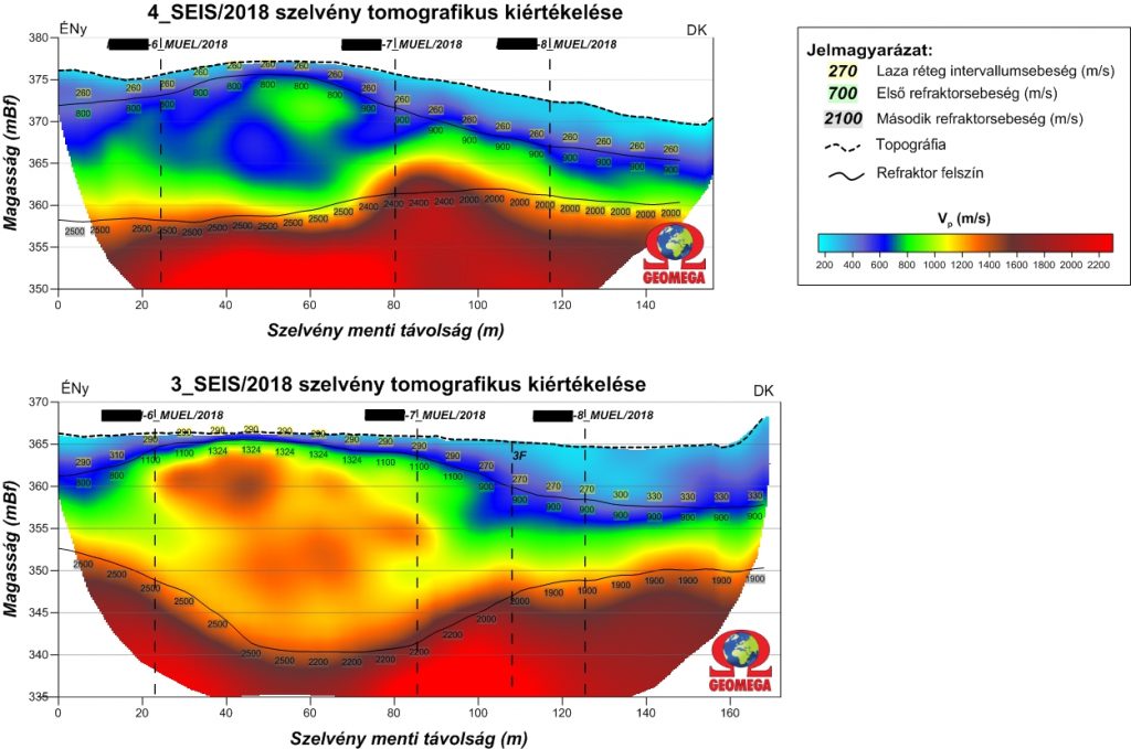
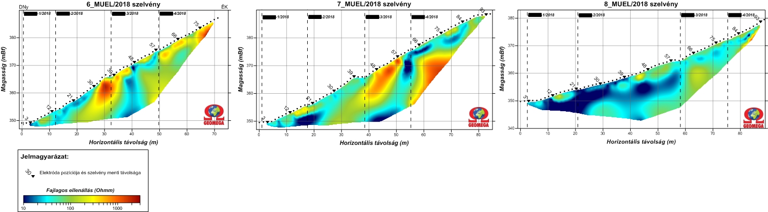
Our task was to establish a spatial connection between the drilling, geotechnical and geological data, as well as to support the engineers in their work for stabilizing the slope. Geoelectric, water seismic and land seismic measurements were carried out on the pit lake and on the slope during the field work.

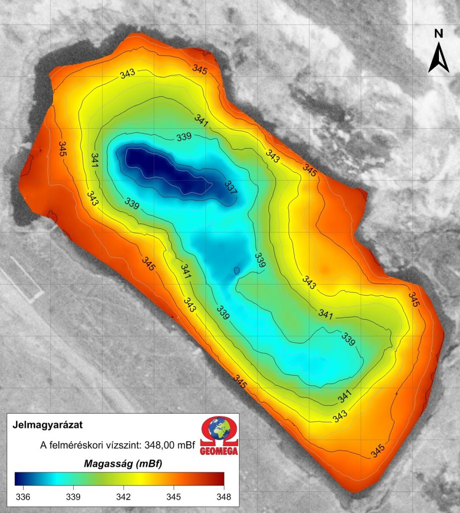
The lake survey clearly showed that part of the slope has slumped into the lake (seen as excess material at the bottom of the lake in the SE part), while the edge of the former excavation is seen on archive aerial photos. This latter is still intact rock even after slope shaping and recultivation.

This is visible also on the seismic sections: the tomographic and seismic refraction results show the boundary of the high-velocity intact rock formations, which is in good agreement with the results of nearby geotechnical boreholes.

On the geoelectric results the clayey layers interbedded into the conglomerate bed can be observed as low resistivity zones. These clay layers are most likely the primary detachment and sliding surfaces of the slumping.

Close Menu