Lake- and Riverbed surveying

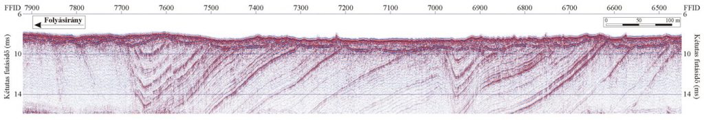
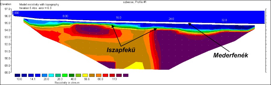
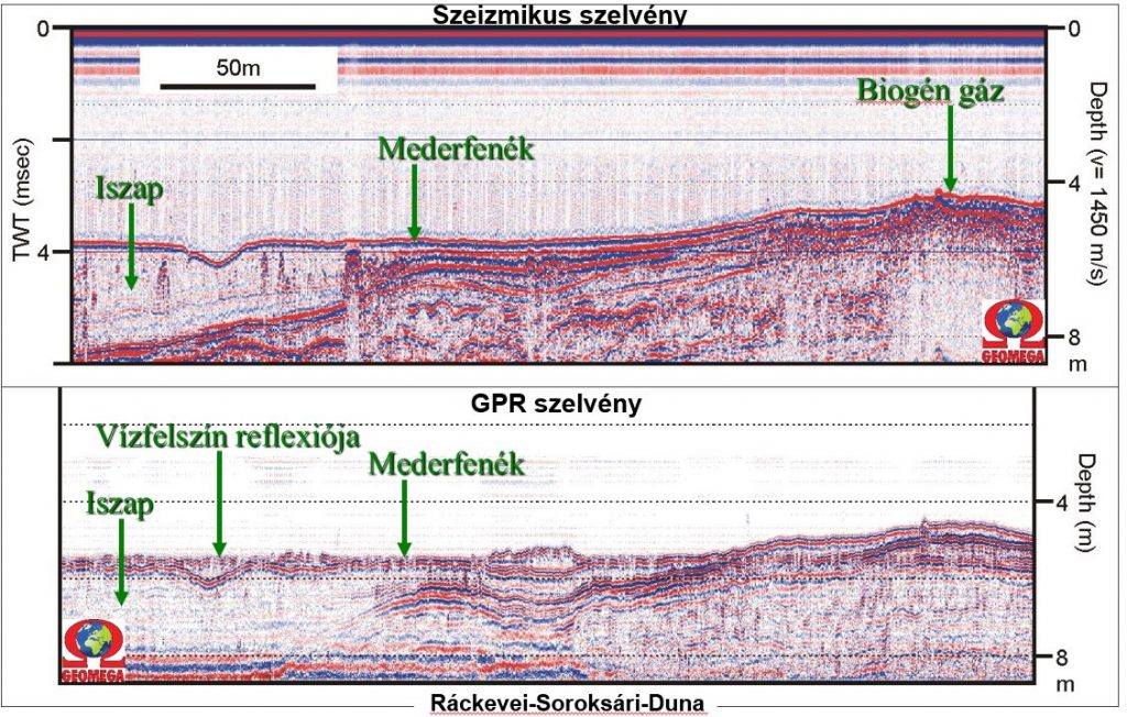
Geomega has been performing high and ultra-high resolution lake- and riverbed surveyings for more than 15 years on the Danube, Tisza, Balaton, Lake Fertő (Neusiedlersee), as well as on several other smaller Hungarian or foreign rivers and lakes. Regarding these surveyings we have unique experience not only on a Hungarian, but also on an international level. Our results obtained from water seismic, water radar and geoelectric surveys as well as from our experienced divers stand on a solid ground even in a wet environment.

Our measurement can be used for:

  • Creating high precision riverbed topographical maps
  • Mapping the base of the mud filling
  • Monitoring the changes in riverbed morphology and riverbed material
  • Volumetric calculations of geological resources in gravel and sand pits
  • Creating dredging and other intervention plans
  • Monitoring pipeline crossings below rivers
  • Environmental impact studies
  • Sub-water geological explorations
  • Archeological surveyings of water-flooded areas
  • Volumetric estimation of revetment

These surveys can be effectively performed both from a small vessel or a boat. Resolution is ~2cm and ~10cm in case of water bottom and within the underlying sediments, respectively.

Using this surveying technique high precision lake- and riverbed mappings, geological investigation of the strata below the riverbed, mapping of the soft sediment infillings as well as volumetric estimation of the gravel beds can be performed quickly and effectively. Volumetric estimation and extension of the revetment for dredging plans can also be done based on the seismic sections. Sub water archeological studies being cumbersome due to dangerous currents or bad visibility can be conducted safely and conveniently from the vessel without needing to involve divers. Due to the peculiarity of the method even the size of the fish population can be estimated.

During sub water radar measurements, the most suitable antenna is selected from our various high-resolution submersible antenna range. Our submersible antennas are fully waterproof and allow for carrying out measurements with the antenna being under water, close to the riverbed even up to a water depth of 5 m. Using the submersible acquisition setup the maximum penetration below the lake or riverbed can be significantly increased.

On the radar sections the soft sediment infillings, objects on or below the riverbed such as pipelines or archeological objects can be marked.

Similarly to land electric measurements during the sub water multi-electrode geoelectric tomography many electrodes, connected with waterproof cables, are placed on the bottom of the water along a linear section. After processing and displaying the results geological conditions below the riverbed can be highlighted.

The method is based on the difference in electric conductivity of the various rocks and sediments. The resistivity is based primarily on the bound- and free (i.e. mobile) water content (and consequently the porosity), and secondly on the mineral composition of the sediments. Based on this the low-resistivity clayey and the high-resistivity (>100 Ohmm) sandy gravel layers for example can be easily distinguished.

Combined geophysical methods

Certain problems requires the joint application of several geophysical methods. By doing this the mapping precision can be increased and the results can better suit the need of the Client.

Close Menu