Numerical geological and reservoir modeling
Modern geological exploration based on digital databases makes it possible to construct numerical tectonic and geological models, that can be used as inputs for the latest modeling and engineering softwares (e.g. reserve and production optimalization calculations, 3D fluid flow modeling, 3D velocity modeling for seismic processings). Geomega has several reverences for constructing 3D numerical earth models based on integrated well log, seismic and core data. Our services cover a wide range of 3D geological modelings:
- Regular 3D grid construction (e.g. velocity field)
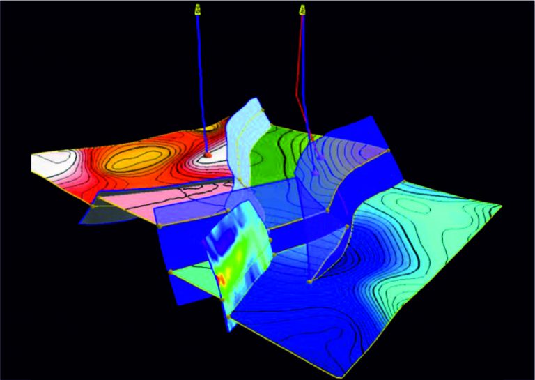
- Construction of geologically consistent structural models
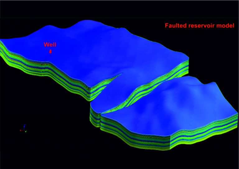
- 3D numerical fault modeling of complex fault systems
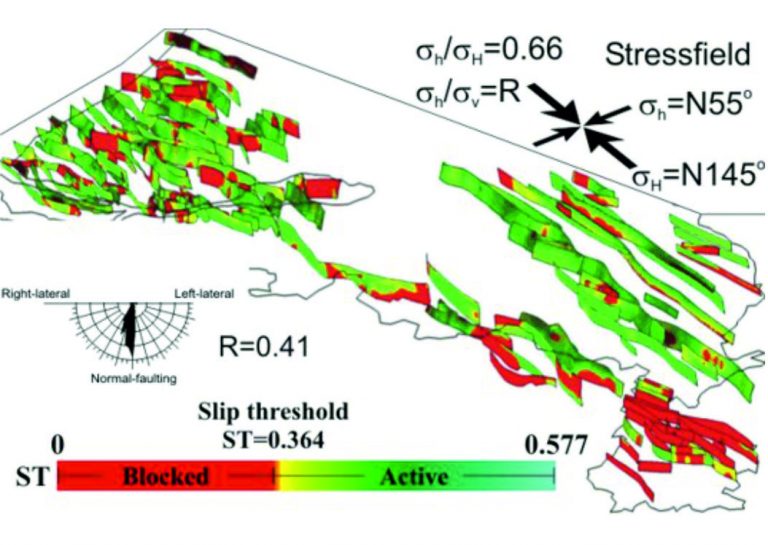
- Slip tendency analysis 3D fault systems, calculation of reactivation potential and slip orientations, identification and characterization of faults capable for reactivation, investigation of hydraulic status of fault systems (open, closed), migration analysis along-fault
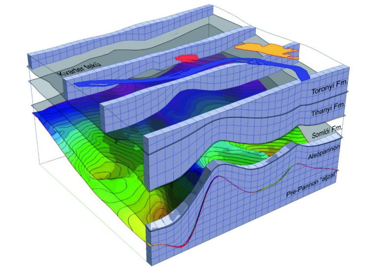
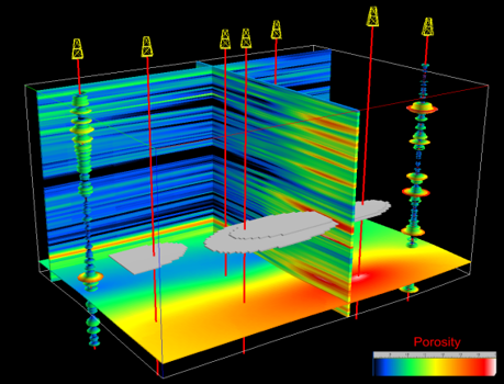
- Construction of stratigraphically consistent, 3D mesh models (SGRID) utilizing calibrated well log and borehole data
- Stochastic and deterministic parameterization of 3D meshes using seismic attributes and borehole data, Gauss simulation
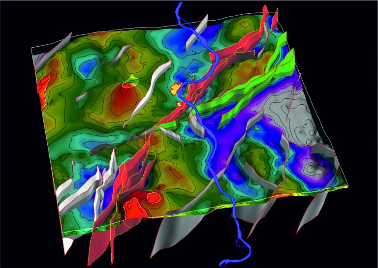
Our numerical geological models consisting of key horizons and faults (both the wireframe and the 3D mesh) are constructed from cross sections, fault polygons, digitized maps and depth-converted seismic interpretations. During construction of these models we take into account the basic tectonic structures and the hierarchy of the fault systems, and we pay special attention to realistic geometries and perfect matching of fault-fault and fault-horizon intersections. Features of our 3D models:
- Structural geologically consistent fault systems, perfect fault-fault intersections
- Crossover-free horizon models
- Realistic horizon faultings, precise match of footwall and hanging fall blocks along the faults
- Parallel or eroded layer terminations in agreement with geological knowledge
- Grid system and cells oriented to faults
- Parameterization (porosity, permeability, velocity, etc.) based on the latest geostatistical methods
- interpolation based on calibrated well log, core and seismic attribute data
- taking into account vertical and stratigraphical trends revealed by geostatistical analysis
- kriging with external drift (KED), collocated co-kriging (CCK)
- stochastic simulation of lithological parameters with equally probability, realizations (Sequential Gauss Simulation; SGS)