Geoelectric tomography
Multi-electrode geoelectric surveying is one of the most advanced direct current geophysical methods. During the surveying metal electrodes are deployed into the ground (called spread, typically involving ~100 electrodes or more), which are connected to the measuring device by electric cables. The total length of the spread depends on the depth of investigation and it can reach several hundreds of meters. During the actual measurement, using variable electrode pairs direct current is applied to the ground and the resulting potential fields are recorded along the survey. The potential field depends on the resistivity pattern of the subsurface. After the measurements part of the electrodes are relocated from the end of the spread to the front making it possible to perform the surveying along a section of any length.
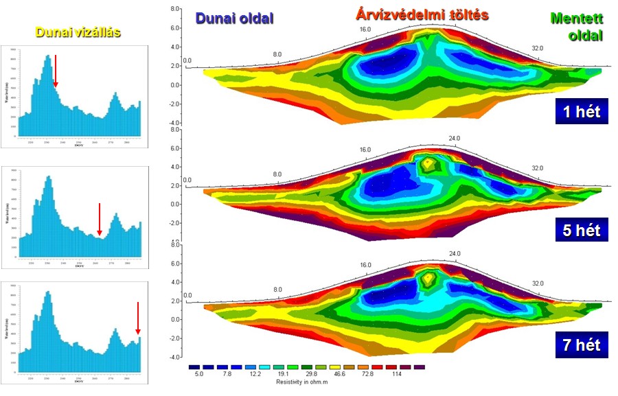
Through time consuming goephysical inversion the large amount of recorded data are converted into so called tomographic resistivity profiles, showing layers and regions of different resistivity. Depending on the measuring configuration the resistivity profile has a resolution of 0,5-1m and allows for the detection and mapping of regions with high resistivity contrast compared to their surroundings, such as tunnels, larger buried objects and geological layers with different resistivity (i.e. gravel beds). We use this method extensively also for groundwater exploration and investigation of flood-protection dikes.
Because of frequent electrode deploying and relocations, implementation of this surveying is rather slow, but the depth of exploration can reach as high as a few 100 meters by increasing the spread.
Our electric cables are completely waterproof, which on one hand prevents false measurements arising from potential electric leakage, and on the other allows the measurement to be carried out even in a completely water-covered areas. We have successfully applied this geoelectric surveying method several times, placing our electrodes and cables partially or completely on the bottom of lakes.