During reflection water seismic surveying high frequency waves are generated on the surface of the water and the arrival time and intensity of the incoming waves reflected from the bottom of the water and from the geological layers below the bottom are recorded. The applied surveying tool is a ~2,5 m long floating device which includes both the boomer and the sensing units (so called single channel survey). The controller and data recording electronics is positioned on a small vessel or motorboat, which tows the floating device during the acquisition.
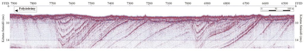
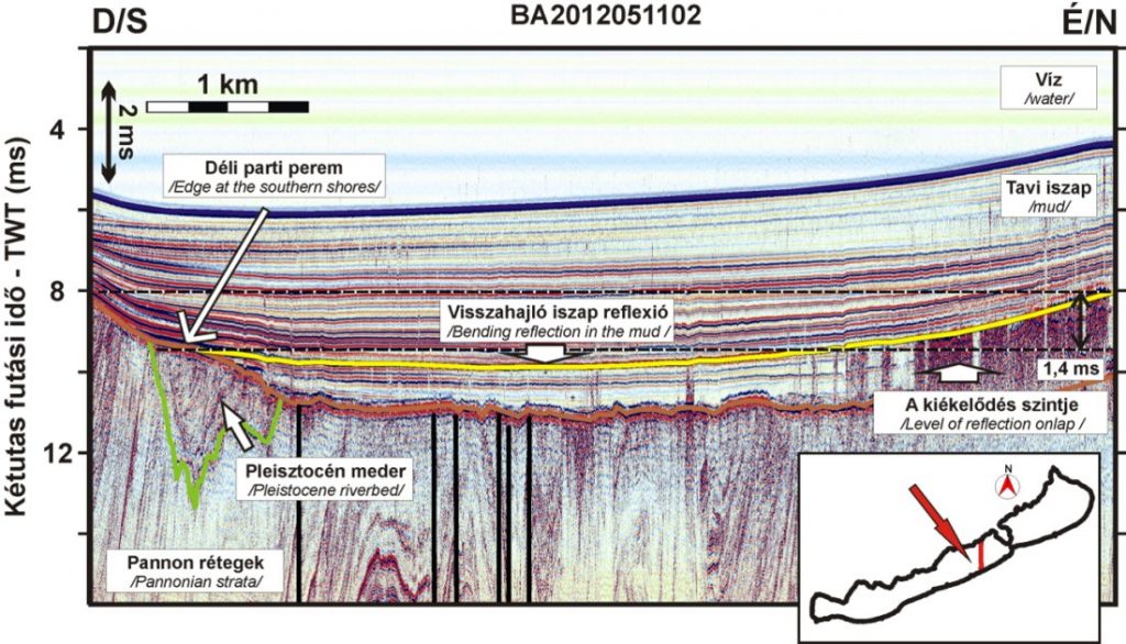
The location of the 2D surveying is positioned by GPS in all cases, which helps to place the results into a reference coordinate system. Conducting the surveying in a dense network a quasi-3D imaging of the subsurface can be obtained. On the seismic reflection profiles obtained from the processing of the data we can determine and map the depth and position of the bottom of the water as well as any sub-bottom geological layers or other reflecting objects. Among many others this method can be effectively used for river and lake bed surveyings, dredging monitoring, mud deposition investigations as well as for resource mapping in active or abandoned gravel pit lakes.