magnetic
The natural magnetic field of Earth is distorted not only by strongly magnetic bodies (i.e. ferromagnetic material) beneath the subsurface, but slightly also by practically any weakly magnetized material. By measuring the magnetic field, these distorting natural or artificial subsurface bodies can be detected and delineated.
During magnetic measurements we measure the magnetic field of the Earth by very high precision (0,01 nT). The device is small, easy to carry and require no direct contact between the ground and the device, allowing for highly efficient surveying, whether in hand-held or trailer-mounted configuration. The surveying is carried out along sections or a grid and is positioned by GPS in all cases, which helps to place the results into a reference coordinate system.
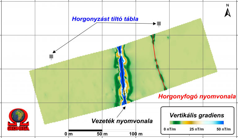
During data processing the raw data is corrected for natural magnetic fluctuations measured by a reference station. The resulting so called magnetic anomaly map shows the distortions of the magnetic field caused by near-surface artificial and geological formations. These include metal pipes and cables, buried magnetizable objects, or objects with termoremanent magnetic properties (i.e. remnants of clay furnaces), however soil disturbances, where historical human interference possibly occurred could also be detected (graves, trenches, remnants of buildings) allowing us to use this surveying technique for archeological support.
The magnetic method has no characteristic depth of exploration: the larger the extension of the body causing the magnetic anomaly the deeper it can be detected, while smaller objects can only be identified, if they lie close to the surface.

